
Museum Campus Skyline Walk: Two Hours Outdoors in Chicago
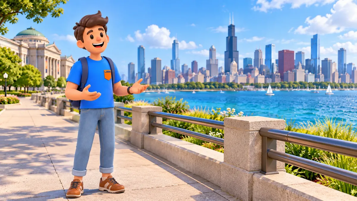
Museum Campus offers a satisfying Chicago outing even when you do not enter a museum. The Field Museum, Shedd Aquarium and Adler Planetarium give the walk a sequence of landmarks, while Lake Michigan opens space between you and the downtown skyline. Henry Moore's sundial near Adler adds a smaller object to look at after the broad panorama. Two hours can give those views room to develop.
This route starts outside the Field Museum, continues towards Shedd and follows permitted pedestrian connections east towards Adler along the Solidarity Drive corridor. It finishes with the skyline near the planetarium and, when accessible, the nearby sundial. Museum galleries, aquarium exhibits and planetarium shows are separate visits. The route also stops near Adler rather than continuing around the whole of Northerly Island.
Give the walk two hours and keep the museum doors out of the schedule
Start on a permitted public path outside the north side of the Field Museum, at 1400 South DuSable Lake Shore Drive. The north side makes a useful meeting point for a walk towards Shedd, rather than an instruction to enter the museum. Continue north and east through the available campus paths towards the aquarium, then take the permitted pedestrian route along the Solidarity Drive corridor towards Adler.
To fit this outdoor route into your whole Chicago stay, try RoadMe: the app builds a personal itinerary around your interests, dates and preferred pace. That helps give major museum visits their own time alongside shorter walks and the rest of your trip.
- Field Museum exterior: around fifteen minutes for the building and orientation.
- Shedd exterior and a first lake-and-city view: around twenty minutes.
- Adler-area skyline viewpoint: around twenty-five minutes.
- Henry Moore's nearby sundial: around ten minutes when the permitted approach is available.
- Allow around thirty minutes for connecting movement and crossings, plus twenty for a pause and small delays.
The total is two hours, based on an editorial allocation rather than measured walking times. Getting to the Field Museum and leaving the Adler area require separate time. This is a route with a different finish from its start, so a return journey belongs in your plan. If you prefer a shorter outing, turn back from the Shedd area and leave the eastern section for another day.
No museum admission is needed for the public outdoor views described here. That does not guarantee access to every terrace, plaza or lakeside path. Read current campus and Park District alerts before setting out, then follow the signs you find on site. Trail repairs, special events and weather can change the available pedestrian route.
Field Museum: use the exterior to establish the scale of the campus
Begin with a view of the Field Museum's broad exterior from the north-side public paths. The building gives the walk a substantial starting point before the open water becomes the main subject. Look at its width, its repeated architectural elements and the space between the facade and the paths. You do not need to climb entrance steps to understand that scale.
Take a moment to identify where you are going next. Shedd lies towards the north and east of the Field Museum, closer to the lake. Let the visible buildings and current campus signs guide the connection rather than cutting across a vehicle lane. Your task is to reach a suitable outdoor viewpoint, not join the museum's entrance queue.
The Field Museum deserves a separate visit if its collections interest you. Even a quick indoor detour changes the outing: entry arrangements, orientation and galleries take time. Do not treat an open entrance as a free indoor shortcut or a guaranteed place to use facilities. This itinerary remains outdoors and complete without visiting a collection.
If you are walking with someone, choose one simple comparison to carry through the route. How does the apparent size of a building change as you move away from it? How much space does it occupy in a photograph when the lake enters the frame? These questions will become more useful at Shedd and Adler than a long list of architectural facts at the first stop.

Shedd: find a public viewpoint without turning it into an aquarium visit
Follow the available campus paths towards Shedd Aquarium, whose visitor address is 1200 South DuSable Lake Shore Drive. Keep clear of ticket queues and entrance circulation, using the public pedestrian space that is actually open. The aquarium is a landmark for this walk; its indoor exhibits are not included in the twenty-minute exterior allowance.
Choose a permitted position where the lake and part of the city come into view. Start with the building near you, then let your attention move beyond it. The lake separates the immediate foreground from the distant skyline, making the city easier to see as a group of shapes rather than a sequence of individual streets. You will return to that comparison near Adler.
Take a broad photograph if you want one, but also spend a minute looking without choosing a frame. Notice where the line of buildings rises, where lower sections leave gaps and how the water changes the sense of distance. You do not need to identify every tower for the skyline to become meaningful. A general pattern is enough to carry to the next viewpoint.
Outdoor circulation around Shedd can be affected by work and visitor activity. Do not assume that a terrace visible in an older photograph is part of the current public walking route. If a preferred position is blocked, take an available inland path or shorten the stop. There is no need to reach the very edge of the water to have a worthwhile view.
Before continuing east, check your remaining time and the conditions. If wind, rain or fatigue already make the open section unattractive, turn the walk into a shorter Field-and-Shedd outing. A two-hour plan should make the afternoon easier to organise, not create pressure to reach the last landmark regardless of conditions.

Continue towards Adler using the permitted paths beside Solidarity Drive
From the Shedd area, follow current pedestrian signs towards Adler Planetarium and the Solidarity Drive corridor. Solidarity Drive leads east towards the planetarium, with the campus behind you and the lake becoming a larger part of the setting. Use the available pavement or signed pedestrian connection; the route does not require following the immediate waterline for every metre.
At road crossings and around drop-off areas, use the designated pedestrian route and remain alert to vehicles. The planetarium's position at the eastern end makes it an easy destination to recognise, but a visible building is not a reason to walk through a closed path or service area. Allow for signed diversions rather than trying to preserve a particular photograph or an exact line on an old map.
The Chicago Park District has announced rolling Lakefront Trail repairs. The work affects different sections over time, so the existence of a general alert does not prove this particular connection is closed. It does mean that checking current information and respecting barriers is part of planning the walk. If a closure prevents the connection, finish on the accessible part of the campus.
Keep the eastern extension focused on Adler. Northerly Island continues south of this area, but its longer paths form another outing. Adding a full island walk to this programme would change both the time and the effort. The skyline and the nearby sculpture already provide a clear finish without a circuit of the peninsula.
Near Adler: look back at the skyline before reaching for the camera
Find a currently permitted public position near Adler from which you can look back towards downtown. The planetarium is the destination at the eastern end of the walk, not an interior stop. Choose your viewpoint according to the space and conditions available that day; no single patch of pavement is essential to the experience.
Begin with the whole skyline, then select one cluster of buildings or one change in height. Compare it with the view you saw near Shedd. The city has not changed, but the relationship between nearby structures, open water and the distant towers has shifted. That difference is the main reason for walking east rather than taking a single photograph at the first stop.
Keep some lake in your view if it helps show distance. Then try a tighter composition and notice what it loses or gains. With a companion, compare which part of the skyline you each notice first. With children, look for a tall-and-short pattern or the boundary between buildings and sky. The activity works without naming every landmark or finding an exact replica of a familiar postcard.
Daylight is a straightforward choice for the walk. An evening visit may have a different atmosphere, but weather, cloud and your actual position determine what you see. Do not build the outing around a guaranteed sunset photograph or clear horizon. If the sky is flat or the distant buildings are hazy, the scale of the lake and the outline of the nearby planetarium can still hold your attention.
Man Enters the Cosmos: a smaller final stop near the planetarium
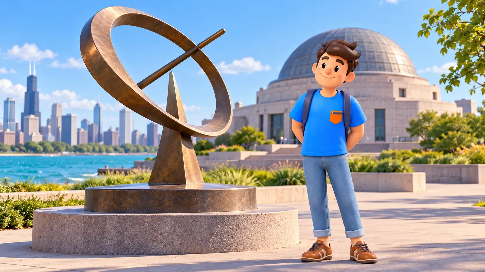
When the approach is open, look northwest of Adler for Henry Moore's Man Enters the Cosmos. The bronze sculpture was installed in 1980 and is an equatorial sundial. Its curves offer a change of scale after the skyline: instead of scanning many buildings across the water, you can give one object a few minutes of attention.
Observe the curved elements, the bar that casts a shadow and the way the form opens towards the surrounding space. In suitable sunlight, a shadow adds another relationship to notice. You need not use the sculpture to determine the time, and this walk makes no promise about the precision of a reading. Cloud does not prevent you from looking at its shape.
If barriers or other current arrangements prevent a useful approach, leave the sculpture out and give the time to the accessible viewpoint or a rest. Do not climb on the artwork or step around a closure to complete a checklist. The lake-and-skyline walk already has its main answer, with the sundial as a nearby addition when conditions allow.
Let lake conditions decide how long you stay
Wind, waves, rain, ice and temporary restrictions can change a lakefront outing. Stay back from an exposed edge when waves or surface conditions make it unsuitable, follow barriers and use permitted inland connections. If conditions prevent a comfortable continuation, shorten or postpone the walk. Museum entrances are separate visitor spaces, not guaranteed shelters or shortcuts for this programme.
RoadMe can help shape a complete personal trip plan around your outdoor and indoor interests, with walks, museum visits and breaks given their own time. Try it to balance the rest of Chicago at a pace that suits you.
If the sculpture interested you, save the two-hour downtown public art walk with Picasso, Calder and Chagall for another part of the trip. Plan your onward journey from Adler separately, especially after a long pause. Here, the museum exteriors, changing skyline and open lake already make a complete outing.


